
ARCHITECTURE | ENGINEERING | CONSTRUCTION
YOUR A/E/C
MEDIA PARTNER
3D animation and drone integration for A/E/C firms that need to win approvals, close clients, and communicate complex projects before a shovel hits the ground.
See Your Project in 3D
Services
Pre-Construction Marketing
1
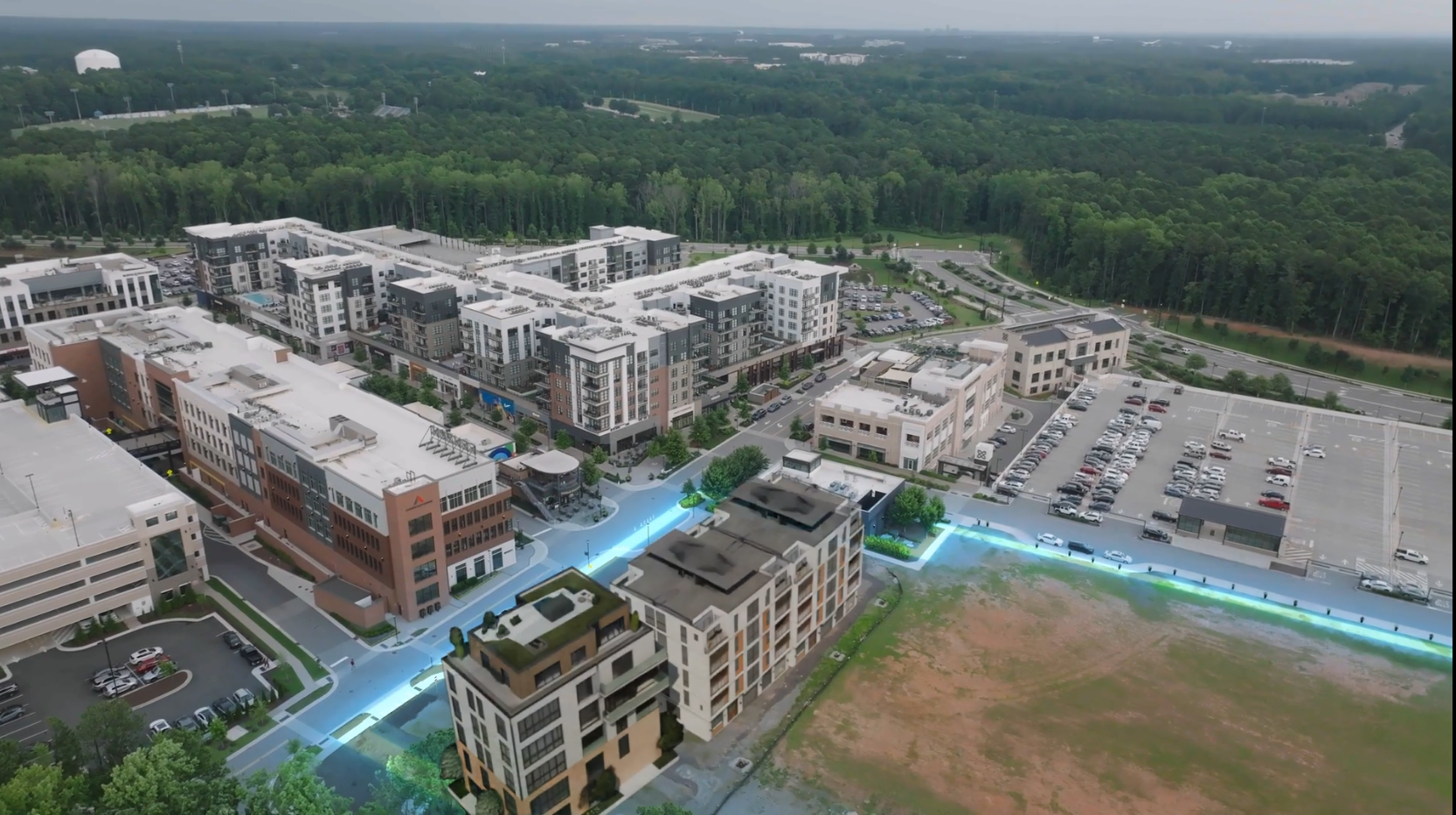
Sell units, secure anchor tenants, and attract investors before breaking ground. Photorealistic fly-through animations of your future development layered over actual drone footage of the site. Or a completely 3D environment built from scratch.
Highway + Infrastructure
2
Getting started is simple. Reach out through our contact form or schedule a call—we’ll walk you through the next steps and answer any questions along the way.
Drone + 3D Integration
3
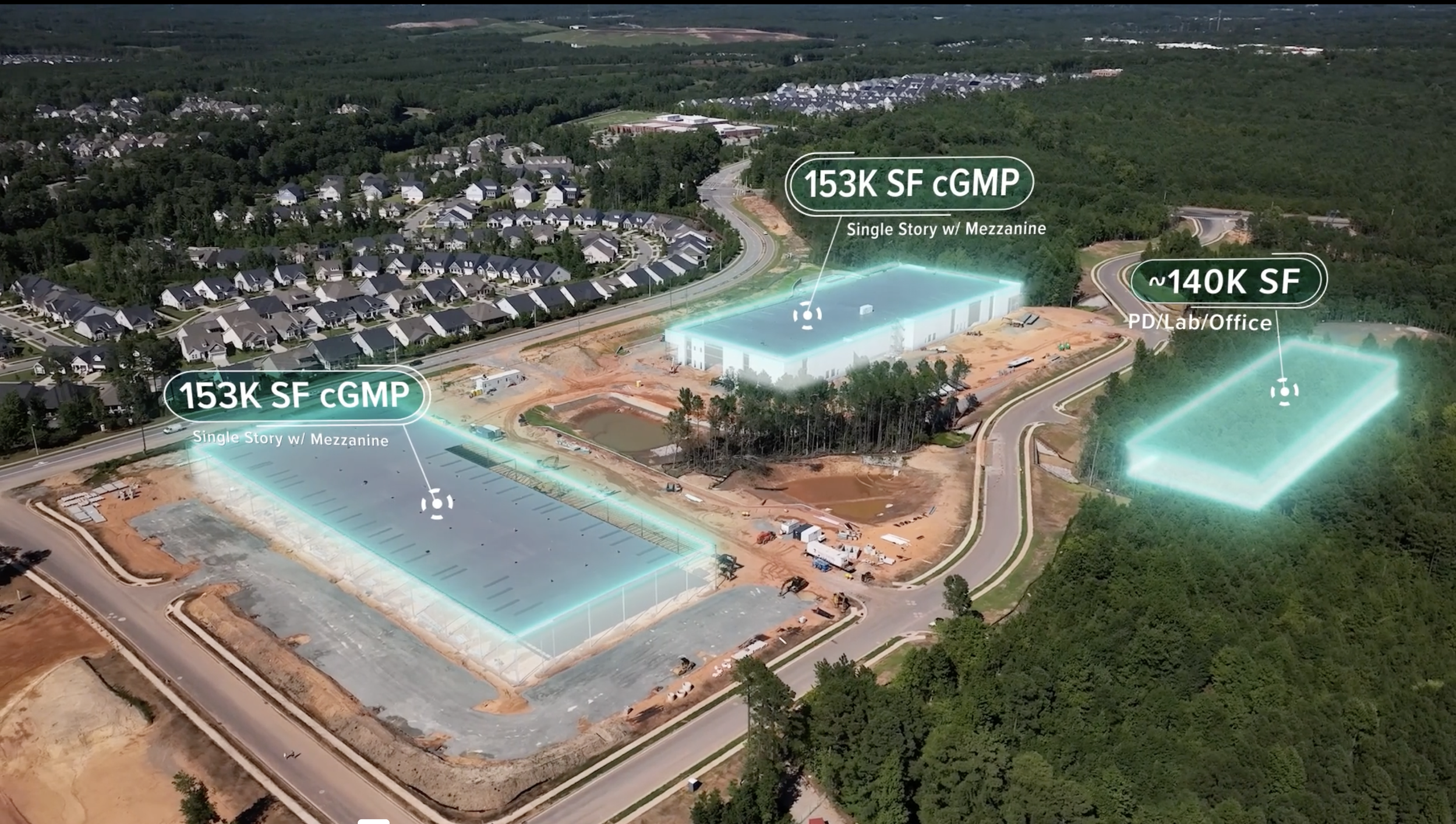
Real aerial photography of your site merged with 3D construction sequences. Show before, during, and after in a single seamless animation. Right-of-way acquisition, property boundaries, infrastructure overlays.
LiDAR Scan + Aerial Photography
4
We can scan your site and create a 3d environment and visualization for use in many applications. We also provided aerial photography and drone site surveying.
Advanced 3D animations footage for real estate developers, law firms, construction companies and anyone who need powerful visual evidence and marketing tools.

🚁 Drone + 3D Animation Integration
Future use planning and transit oriented development visualization
Show the impact of roadway upgrades and improvements
Right-of-way acquisition visualization with 3D property boundaries overlaid on drone footage
🏙️Real Estate & Property Development
Before/during/after project visualization using actual site conditions
Precise 3D models integrated with accurate aerial photography
Real-time drone footage overlaid with 3D construction sequences
Drone footage of actual development sites with 3D building overlays
Height and density visualization using actual neighborhood context
Future expansion phases with realistic 3D development progression
Show the impact of roadway upgrades and improvements
🛣️Highways & Transportation
Future use planning and transit oriented development visualization
Right-of-way acquisition visualization with 3D property boundaries overlaid on drone footage